
This is it. I’m declaring Blog Bankruptcy. I’ve gotten so behind with summer travel and outings that I can’t possibly dig out of the hole. So here’s what I did this weekend. I may go back and cover selected trips from June-August, highlights of which included 2 weeks in Turkey and Romania, summer skiing at Mt. Rainier, and backpacking near Glacier Peak.
Mt. Howard and Mt. Mastiff
7063′ peak elevation
12ish miles
6000′ gain
7:40 car to car
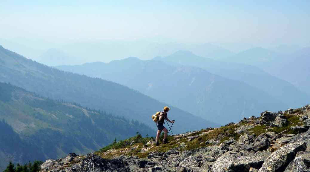
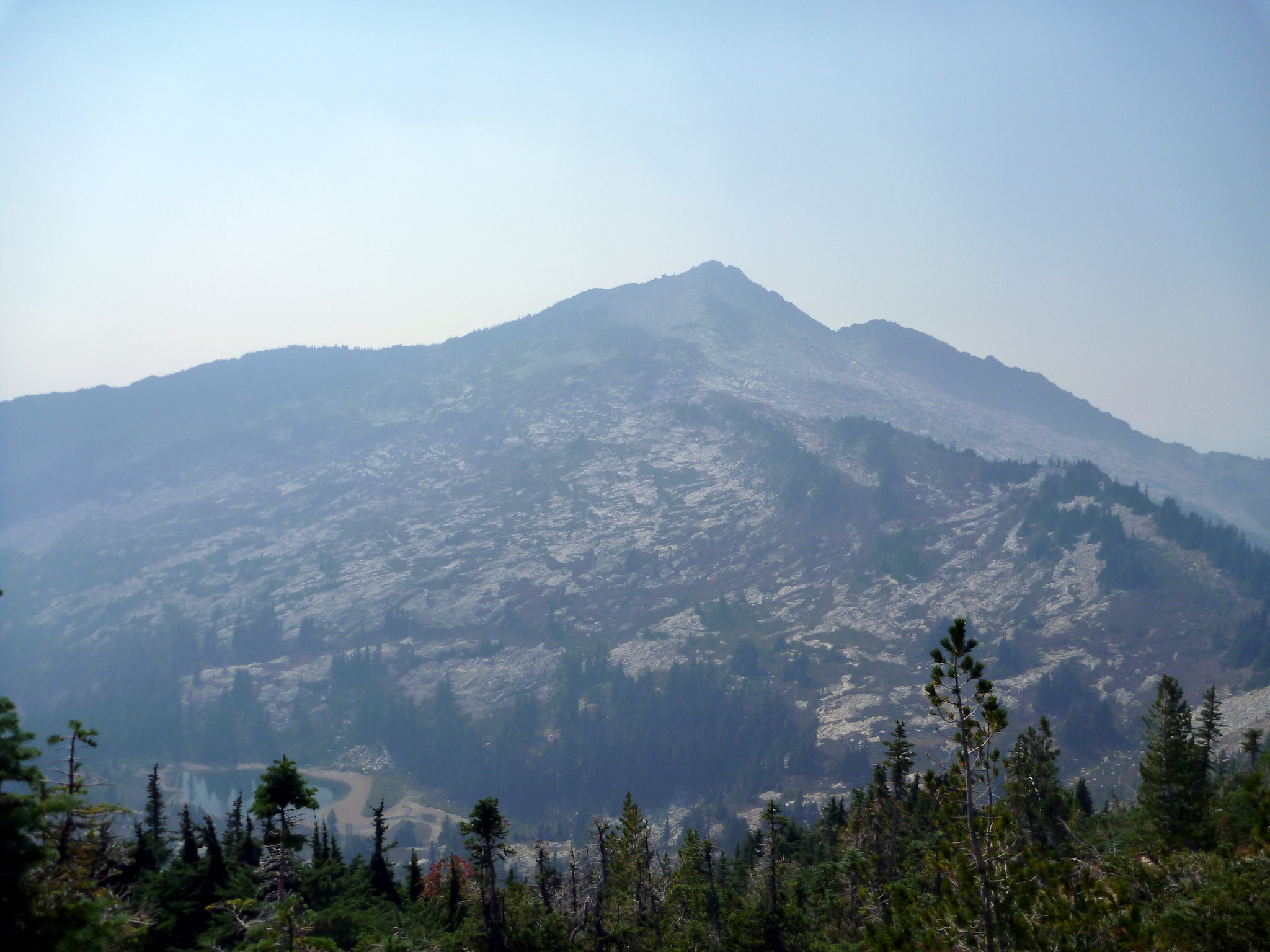
DATELINE: Chelan, WA. After one of the driest springs and summers on record and with a minuscule snowpack, Washington is burning. Lake Chelan, the Methow Valley, and Mt. Adams are ablaze and the Okanogan Complex is the largest in the state’s history. With the North Cascades Highway closed due to fire, the options for getting in the high country are more limited than usual. Looking for a fun summer scramble, hiking pal Becca and I settled on a doubleheader near Stevens Pass, hopefully sparing us most of the smoke: Mt. Howard and Mt. Mastiff. Mt. Howard happens to be a 2000′ prominence peak, a nice bonus.
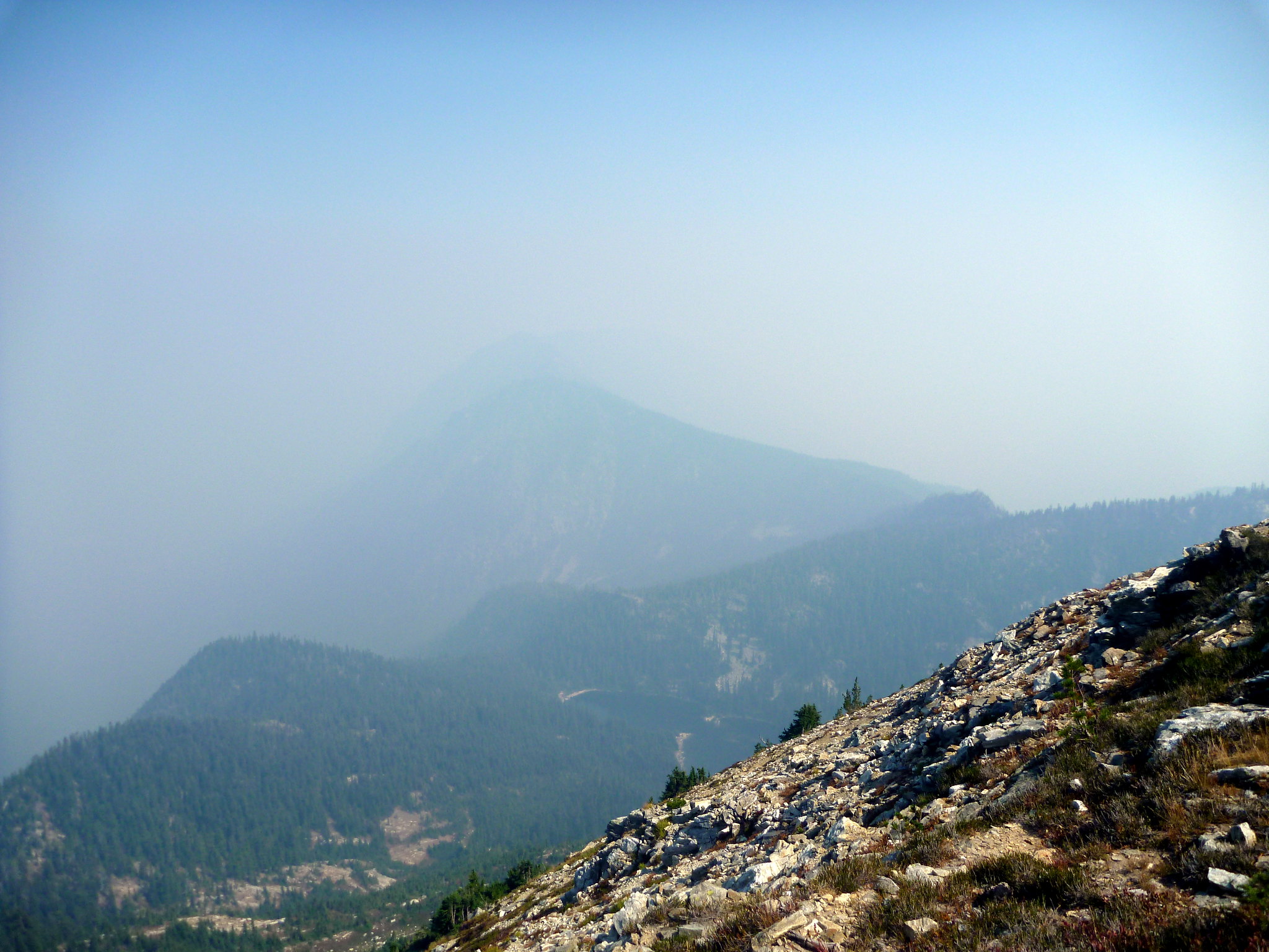
On the drive in we noticed a puzzling haze in Monroe – it couldn’t be smoke, could it? We were 100+ miles from the closest fire. As we continued along US 2 it became evident that the forecasted NW wind hadn’t materialized – Easterly wind was pushing the smoke our way. Despite the potential for disappointing views, the smoke wasn’t thick enough to irritate our lungs or eyes so we elected to do the trip as ash fell from the sky like a dusting of snow.

Our plan was to do a loop route starting and ending from the Merritt Lake Trailhead, climbing Mt. Howard first before continuing on to Mastiff and descending off trail on Nason Ridge. Fully half this route is off trail, so decent routefinding and navigation skills are definitely required.
The Merritt Lake trail has nice efficient switchbacks through mostly shade. The Nason Ridge trail though needs some work – it’s brushy and loose in places but easy to follow. It continued through a looong traverse over to Crescent Lake including several hundred feet of elevation loss (beware to those doing the counterclockwise loop!) There are several little bowls that look like the S. face of Howard – make sure you’re in the right drainage (ie. not Royal Creek) before you head upward.
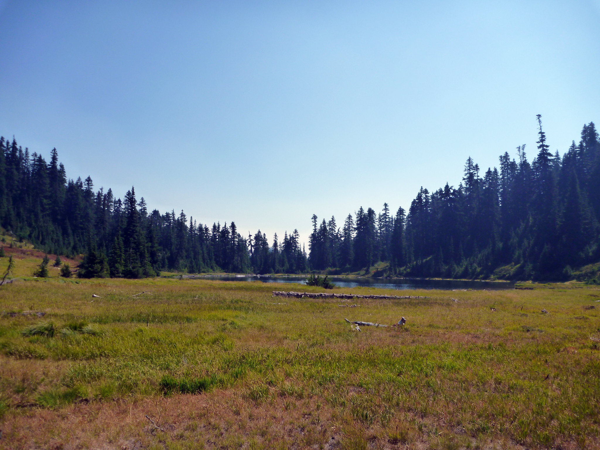
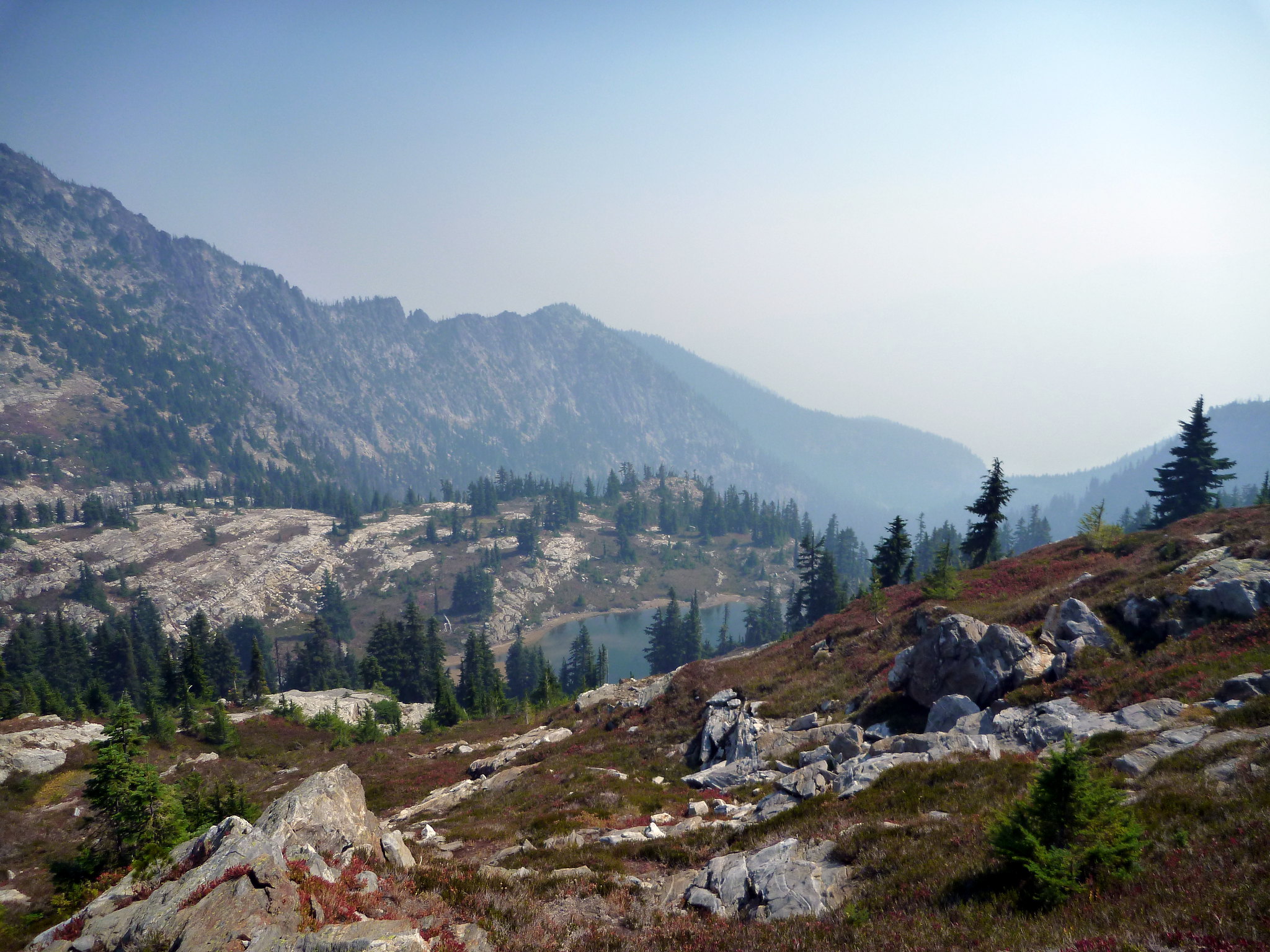
Crescent Lake is big and shallow. It looked like elk bed down in the long grass nearby – comforting, as we had just been startled by some sort of large mammal in the woods and we were really hoping it wasn’t a bear. We filled up water and started up the South face of Mt. Howard (about 2000′ vertical) off trail. We took the talus field at the head of the lake (directly below the obvious cliff band) then brush bashed through some woody plants without too much hassle before reaching an upper talus field where we drifted right to get around the cliff. There are several gullies here – we picked the one we thought was easiest and it was easy but loose, dirty class 3. I wouldn’t want to have to descend this part if I could help it.
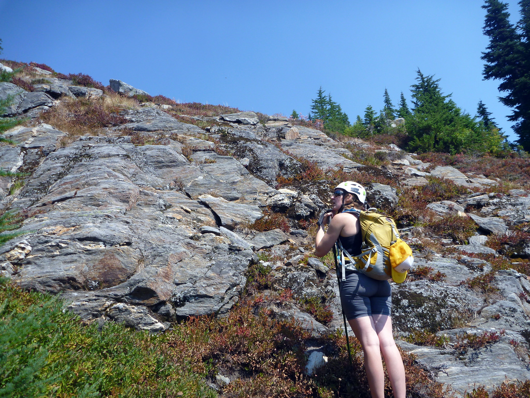
Above this crux band of 100′ or so it was easy cruising on talus and dirt climber’s trails to the summit.
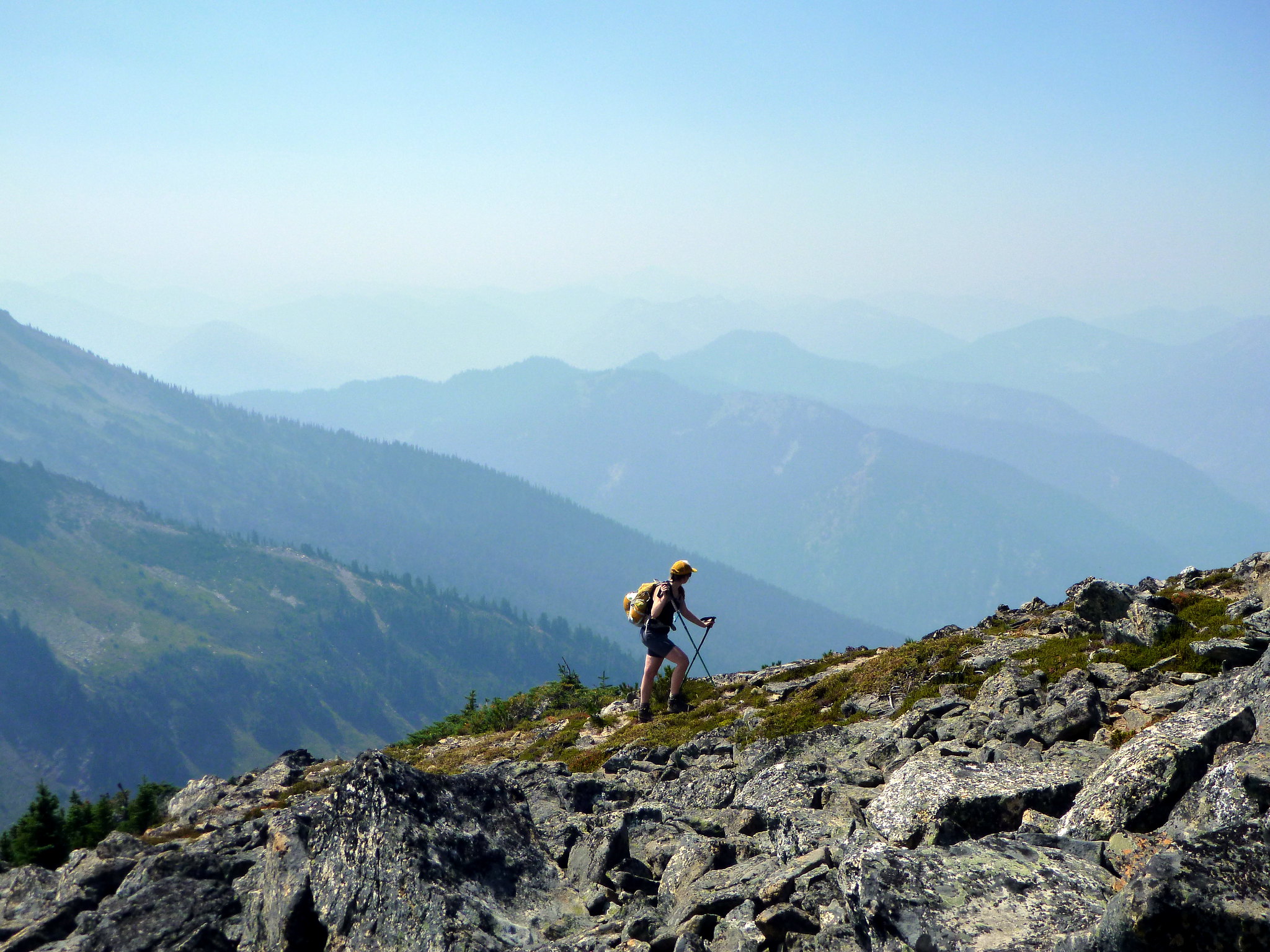
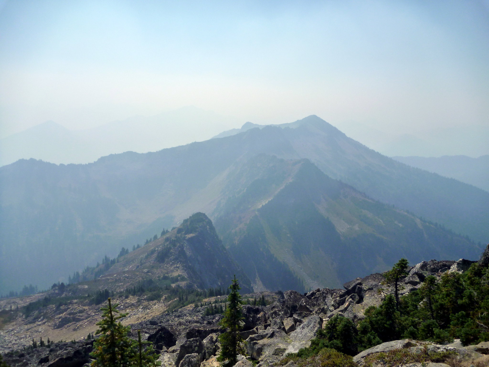
The summit would have pretty awesome views – unfortunately, the smoke continued to roll in and we could only see a mile or two. The summit had a nice register; it looks like not too many people make it up here. The route down to the saddle with Mastiff doesn’t look straightforward as seen from the true summit, but a couple hundred feet along the shoulder the terrain moderates considerably, allowing us to continue along to the next summit.
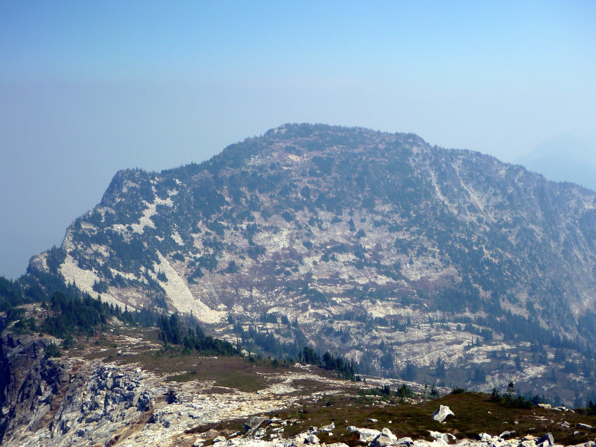
The saddle between Mastiff and Howard is really nice! Canaan Lake would be an excellent campsite if not for the tough scrambling approach from both directions.
We ended up staying lower than the ridge and following a heather-covered “ramp” up the SW face of mastiff for around 500′ of easy scrambling to the summit, which has a nice view of Lost Lake and another register.
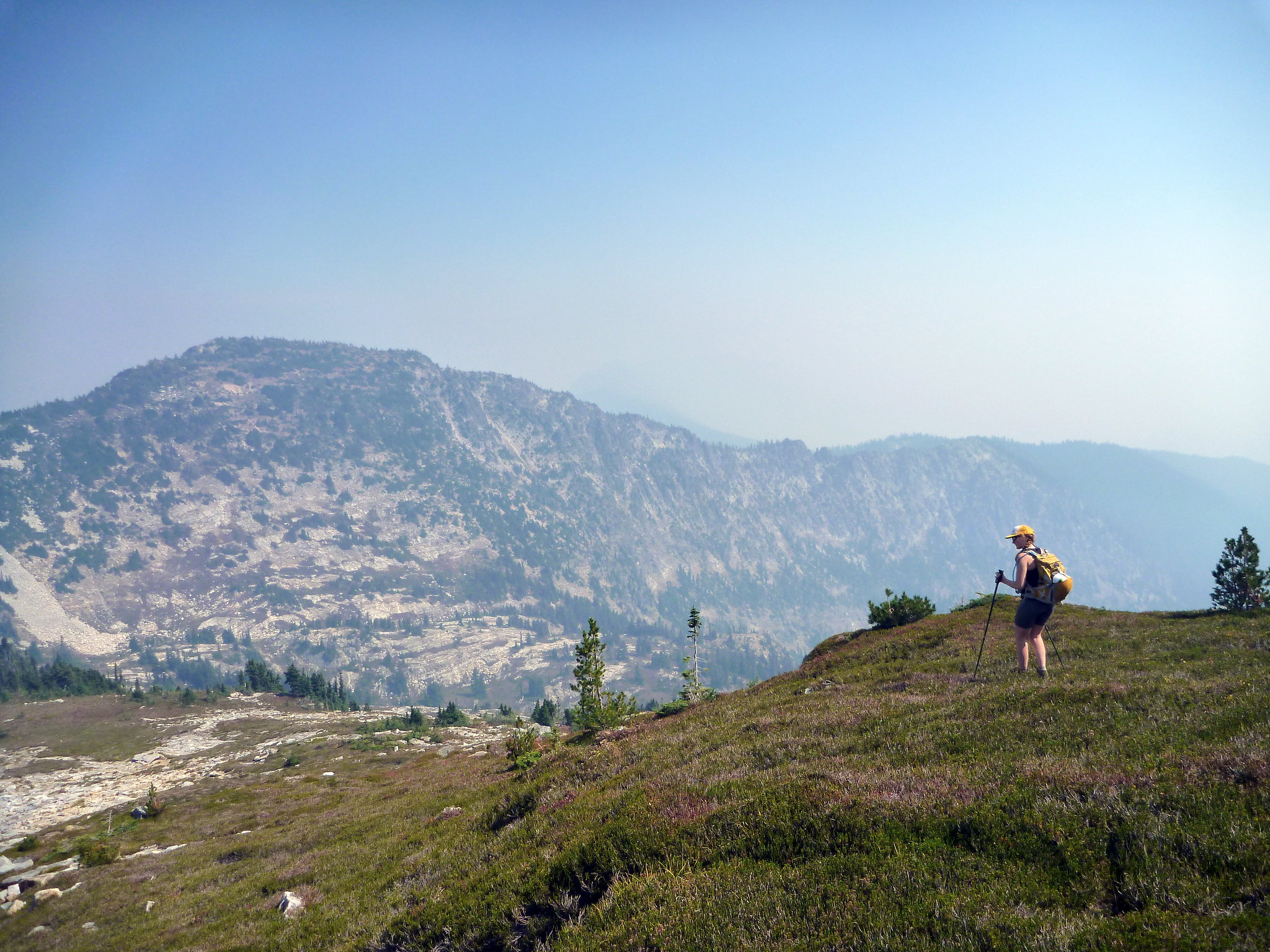
The light dipped slowly lower in the sky as the afternoon progressed and we started our descent along Mastiff’s long SE ridge. The smoke gave the sunlight a reddish tint – with the shade on the easterly slopes, it felt like nightfall was on the way even though it was barely 4pm on a summer day. From the summit, we followed informal trails on the east side of the ridge until it became noticeably steeper on that side. We poked around to find a way through (following several false trails through loose, very steep terrain with bad fall potential) before coming to our senses and regaining the very top of the ridge. This is the way through the narrow part – stick to the top and it goes without too much scrambling. We saw that a dog had made it through with a couple, but I wouldn’t recommend that…
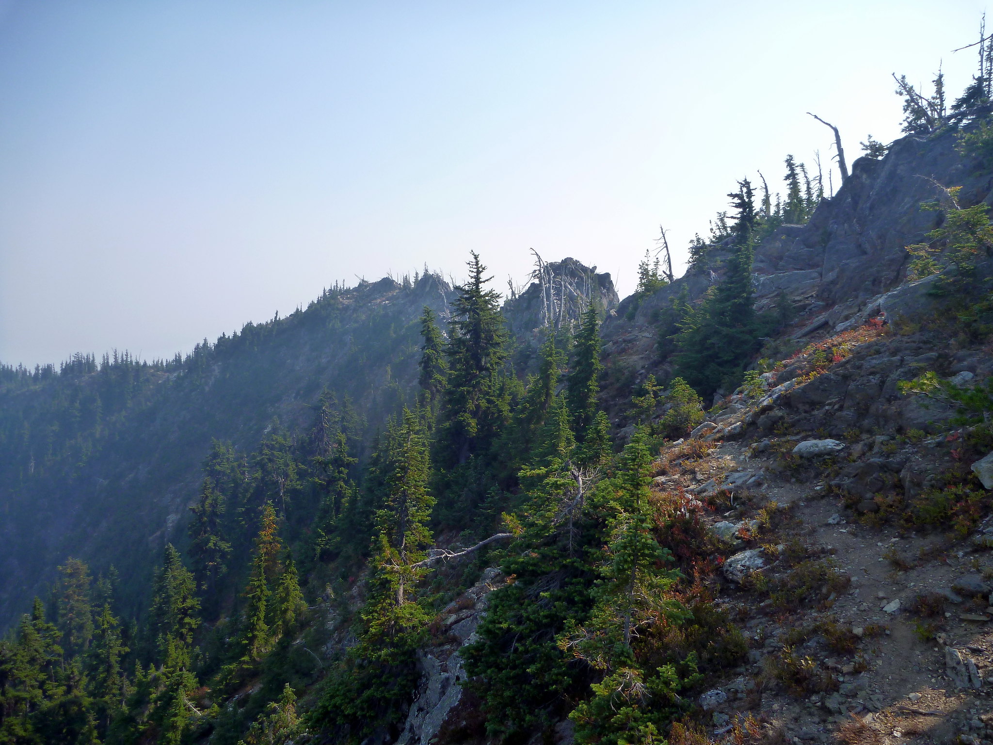


Soon enough the ridge mellows out again and a well established unofficial trail follows broad, descending terrain until it regains the Nason Ridge trail at the very end. With a few switchbacks, we found ourselves back at the intersection with the Merritt Lake trail and hiked out the rest of the way to filtered air in the car and a burger on the way home.
This hike might be a repeat candidate since we missed out on the views: perhaps as a spring ski tour?
Tiger Mountain Trail Running
On Sunday I ran around Tiger Mountain State Forest for a workout but it didn’t go as planned – I ended up between West and Middle tiger in some remote (well, for Issaquah) terrain and a trail I scoped out on Google maps didn’t actually seem to exist in real life, so I had to backtrack the whole way out.
I have no pictures since I was conserving battery for my “navigational challenges” – frustrating. I saw a snake, a banana slug, and got about a pound of spider web on my face on the nearly unused Tiger Mountain Trail. Probably 14 miles, 3000′ gain.

Fantastic photographs!
LikeLike