
Since Simon and I had planned to hit Moab this weekend, I figured we could spend one day high in the La Sal mountains. Inspired by a SummitPost log, we planned an epic day traverse of the Middle La Sal range including all the highest peaks in the area. 
The plan was this: camp in Gold Basin on Friday night, get up early, and hike up the north ridge of Tuk. Then, traverse along a sort of circular ridge to hit Mt. Peale, the highest in the range, and catch Mt. Mellenthin on the way back to the car. We expected that the ridge run would probably take 6-8 hours.
The drive to Moab was uneventful until Green River, when we saw a whole bunch of smoke in front of the La Sals! This was not in the plan! We were pretty bummed until we got to Moab and found out the true location of the fire. By now, the wind had shifted to the West so the smoke was heading south around the alpine area we were headed to. We decided to give it a shot anyway.
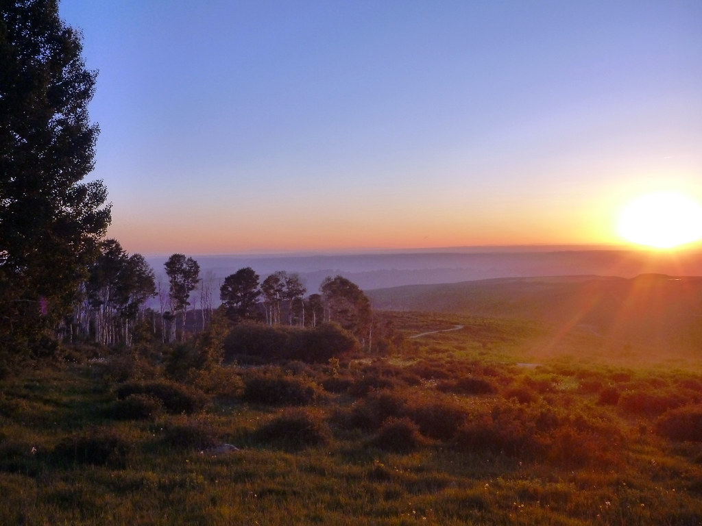
We camped in the last site along the road to Gold Basin, and it was very lovely except for a few mosquitoes that went away with spray. The stars late at night when the moon set were amazing.
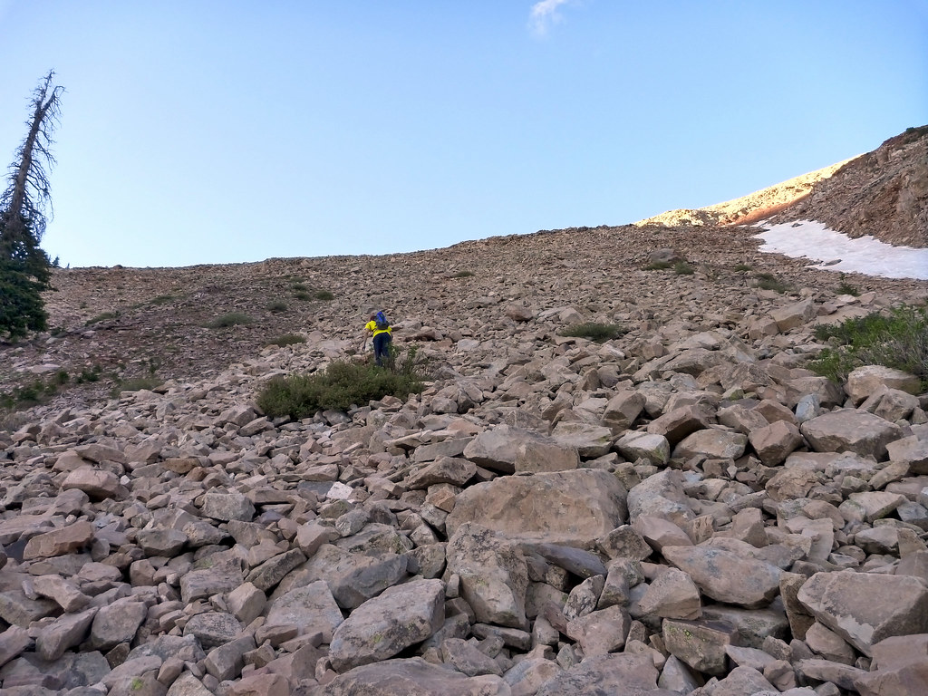
The next day, we got up and hit the trail by just before 6am. The starting boulderfield was loose and kind of a pain but not dangerous.
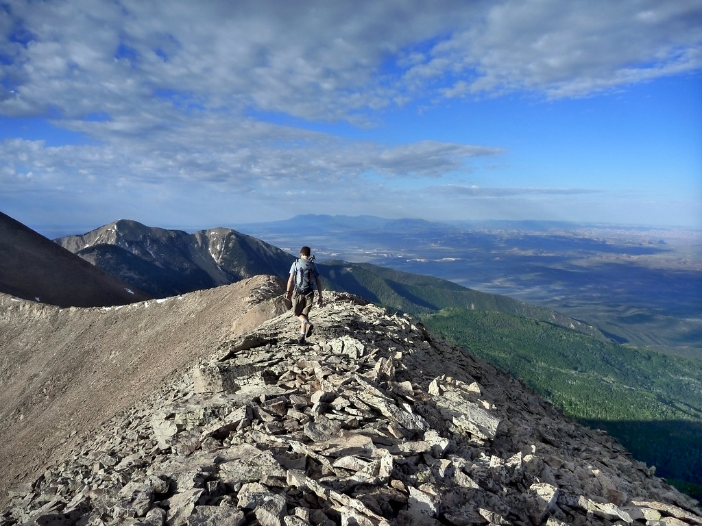
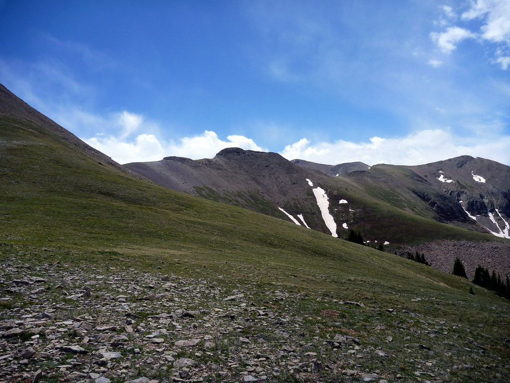
After gaining almost 2000′ in less than two miles, we hit the ridge and cruised up to North Tuk. Up here the open alpine terrain is inspiring. It’s easy movement, easy navigation, and great views 100% of the time.
We summited Mt. Tukuhnikivatz about 2:30′ after starting from the trailhead. It was windy but not unpleasantly cold on top, and we stopped for a quick bite before hustling down the east ridge to the Razor Fang.

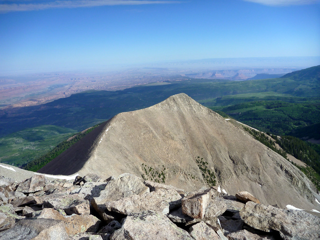
Tuk is the westernmost peak in the La Sals and has unobstructed views of the desert to the west.

The ridge down to the eastern saddle should have been easy but I got complacent, slipped on a steep section of talus, and sliced my hand up a little. It will be a cool scar in a couple of weeks.

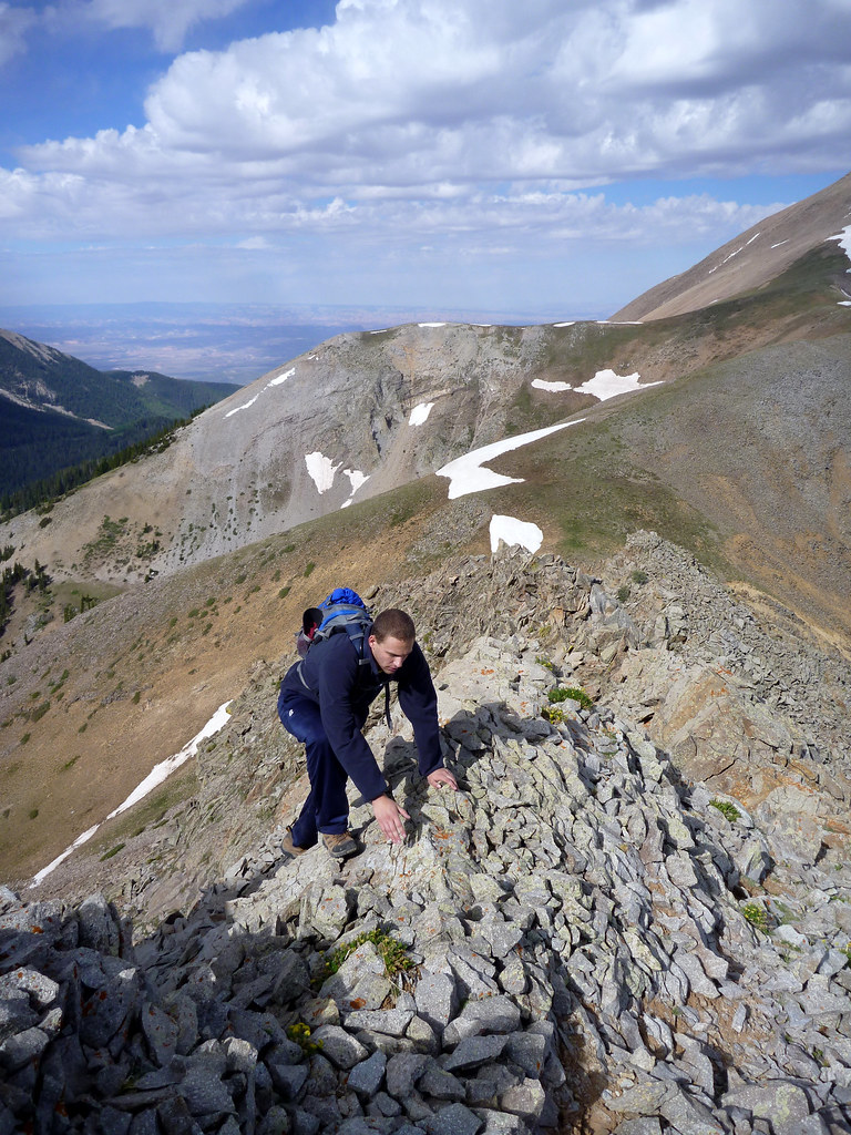
The crux of the route is a 2 or 3 hundred foot section of rotten rock scrambling called the “Razor Fang.” I brought a helmet for this section since it had the reputation for raining down rock chunks on people.
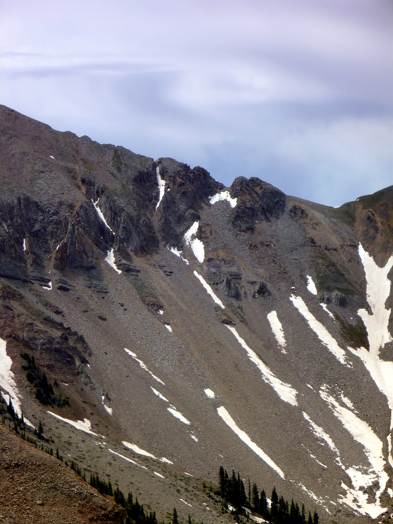
It was very loose, but the exposure was not as bad as I was expecting. There is one borderline class 3/4 move exposed to the south with terrible holds, but with careful selection a few solid rock chunks may be found. Just be careful not to drop some on your partner. Don’t go too far to the north, it looked very jagged and exposed and the route goes at Class 3 by selecting a middle line. The section made me nervous (I like solid rock thank you) but Simon really enjoyed it. Just don’t bring an 8 year old or a dog or something.
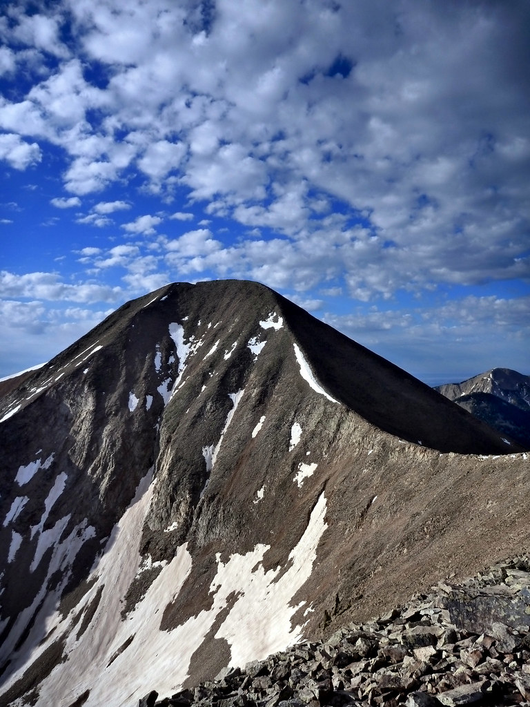
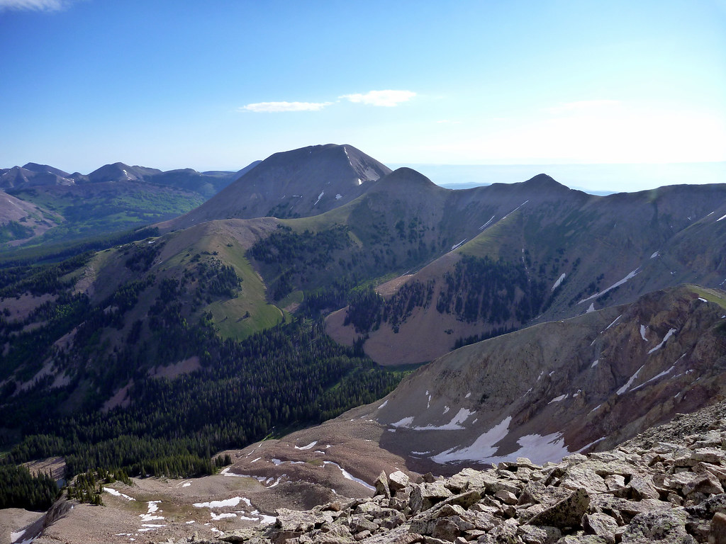
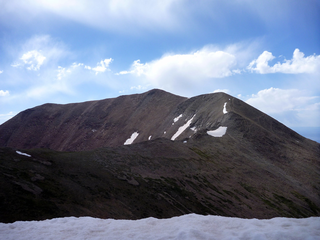
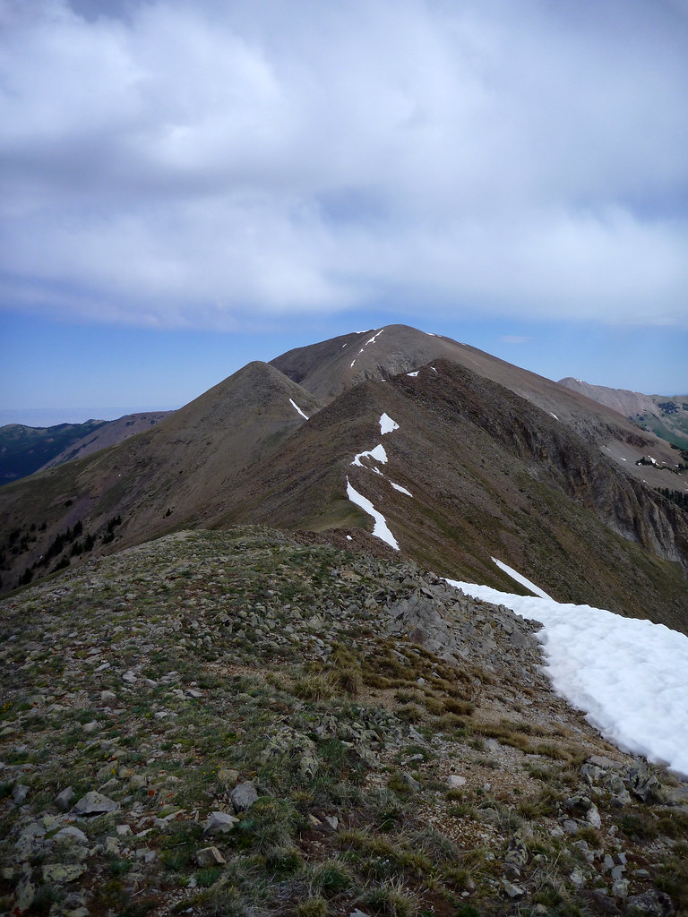
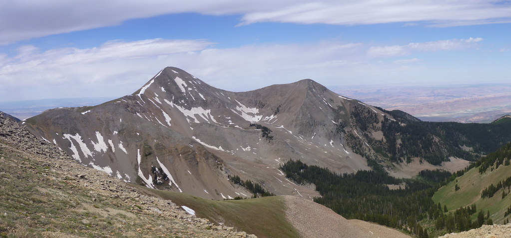
After the Razor Fang, we had around 900′ vertical to regain to get to the highest summit on our list, Mt. Peale. Mt. Peale is an “ultraprominence” peak, meaning it rises several thousand feet above the desert below. Its North Face looks impressive from the ridge and we were excited to get on top.
The wind started to pick up as we wound our way along the open ridge. Soon, we were getting pelted with graupel. This is usually an indicator of storm activity so we knew we needed to hustle to get off of Peale.
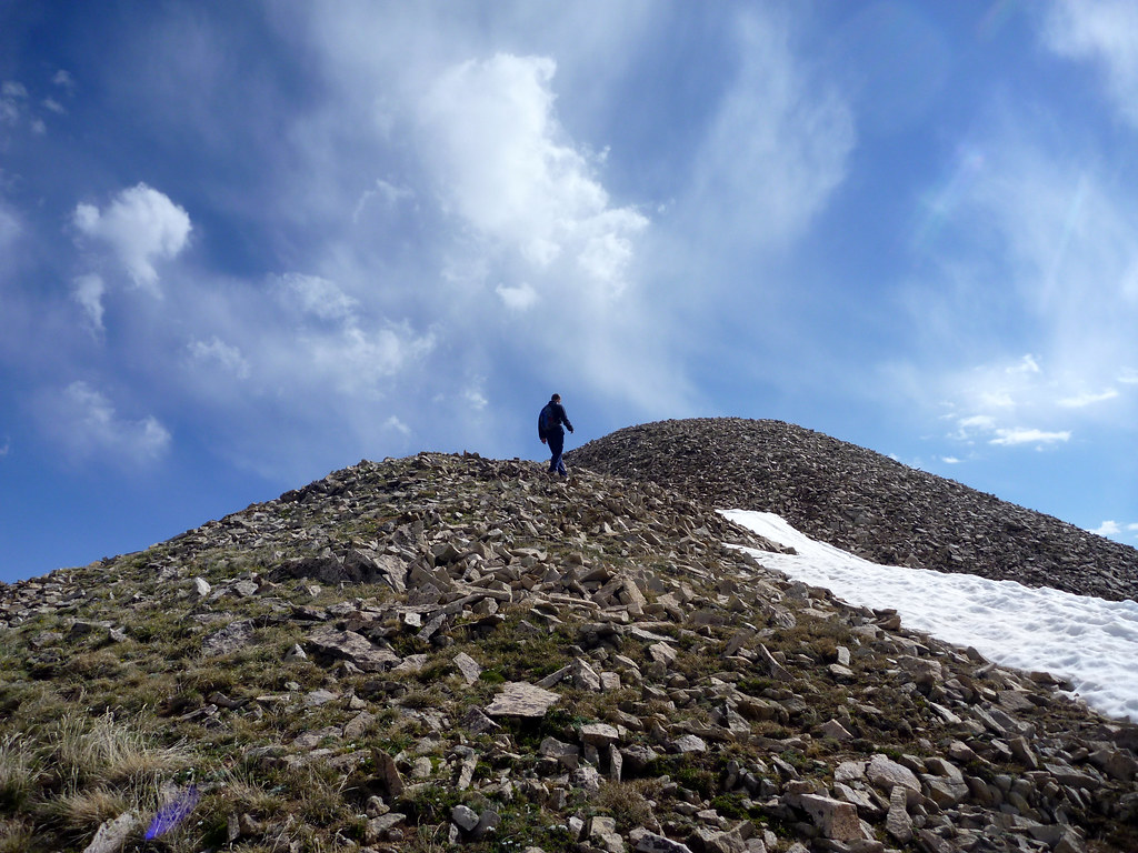
Finally, we stood on top of Mt. Peale, about 4:30 after leaving the trailhead. We snapped a few photos, threw on our puffy jackets, and got ready to hustle back to the car before the storms roll in.
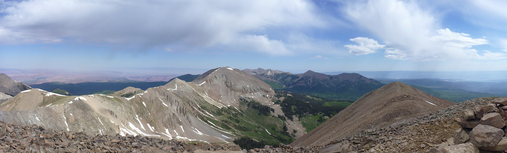
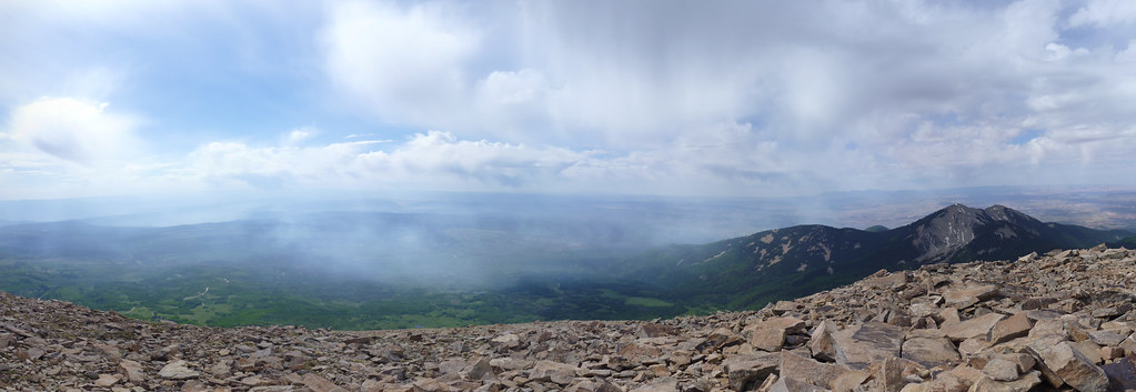
Looking south, we could see the evidence of the forest fire, leaving a thick haze of smoke which obscured the view in that direction.
I broke my altitude record for the second time that day, and it will stand at 12,721 for the foreseeable future (potentially hitting a Colorado 14’er on the way home in August).

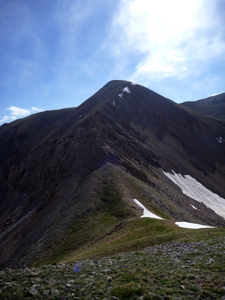
The cloud continued to look questionable and more were building to the West, so we decided to cut the day short and agree to bypass Mt. Mellenthin on the way back down. We had already hit our two highest priority objectives so Mell would have been a pointless slog. We were also feeling the altitude, having slept at 10k’ and spend the whole day above 12k’.

The ridge back to Mell was routine but we enjoyed the sights and downhill trend.
We skipped climbing Mt. Laurel and contoured around to its NW ridge. Here we stopped for a rest since the sights were grand – the colors changed and signs of life started to appear.

z
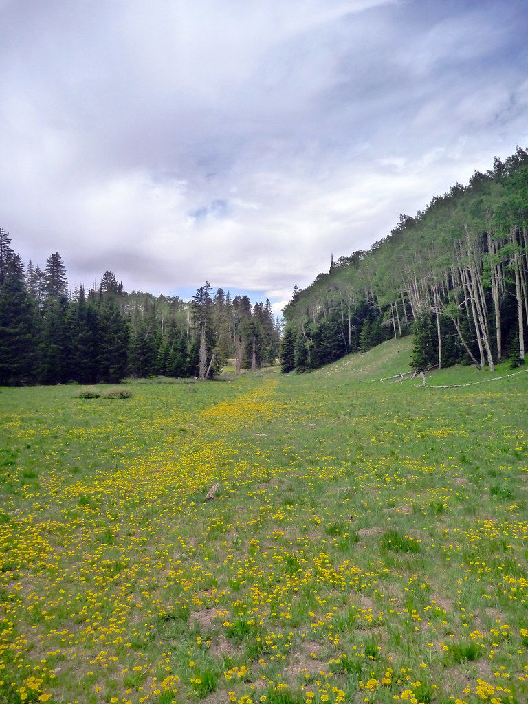
We were happy to get below treeline by about 11:50, 6 hours after starting from the trail head. After half an hour of bushwhacking down the correct gully, we came out 100 yards from the car in this nice meadow where we camped.
We were excited to have spent the whole morning off trail but it was a grueling pace and we were happy to be off our feet in the car for the drive back. We were in Moab by about 1pm and ready to hit Arches National Park. Another post to come soon!
